
Recently on Cyclingnews.com |
94th Tour de France - ProT
France, July 7-30, 2007
Tourist's guide to London: Stage 1
|
Following on from his Tourist's guide to the Tour de France Prologue route, Cyclingnews scribe Ben Atkins has donned the lycra again to give you an insider's look at Stage 1, where the world's top cyclists will follow in his footsteps next week, albeit a little quicker.
The Tour de France's Stage 1 starts at the point in London that the Prologue left off - The Mall. This is London's grandest boulevard, drawing a straight line between Buckingham Palace - the Queen's official residence in London - at one end and Trafalgar Square - via Admiralty Arch - at the other.
This road is no stranger to sporting excellence as, apart from yesterday's prologue, this is the spot where the London Marathon finishes each April. Of course it was the place where then World Champion Tom Boonen won the sprint from Britons Roger Hammond and Mark Cavendish, to take the final, and most prestigious, stage of last year's Tour of Britain. Boonen and Cavendish will both be here for this stage, and they'll both be looking for victory in Canterbury on this afternoon.
|
Opposite the park is Waterloo place - featuring a victory column with a statue of the Duke of Wellington on top. Yes, it's him again. We saw a lot of him yesterday, but he was a pretty successful - and very rich - bloke, so he has a pretty big presence in this part of town. Waterloo Place leads to the beginning of Regent Street, which heads up to Piccadilly Circus and on to cross Oxford Street in London's principle shopping district.
|
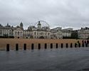
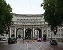
At the top of The Mall is Admiralty Arch, part of the headquarters of the Royal Navy, but before we reach there, over to the right is the main parade ground of Horse Guards. This is the location where each June the Trooping of the Colour ceremony takes place where the guards - and other regiments - parade for the Queen's Official Birthday. As a bit of a contrast, this is to be the venue for the beach volleyball tournament during the London Olympics in 2012.
At the far side of the parade ground, an anonymous looking brick wall hides the back gardens of Downing Street. There is plenty of high security here, including CCTV cameras and barbed wire. As with the gates on Whitehall, it's not clear whether these are here to keep us out, or them in! I wonder whether recently installed Prime Minister Gordon Brown will be in, to see the race pass so close to his new house. I would be!
Passing through Admiralty Arch, we enter Trafalgar Square. Apart from being a celebration of the great sea battle with Nelson's Column at it's centre, this is also a meeting point of several of the capital's major streets: if we turn 90 degrees to the right we are on Whitehall - home to much of Britain's government departments, and where the Prologue started yesterday; to the left is St Martin's Lane and the Charing Cross Road which lead up towards Covent Garden and the theatre district of the West End and Soho; straight on is the Strand, one of the most fashionable parts of London during the first half of the 20th century, boasting such establishments as the Savoy Hotel and Simpson's in the Strand. Today though, we are taking the second right, heading towards the River Thames down Northumberland Avenue.
|
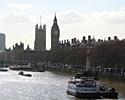
To the front, we are heading towards something that we saw in yesterday's prologue: the Houses of Parliament. Riders once again get a chance to check the time, before they turn left again onto Westminster Bridge and the first of three Thames crossings. From the bridge the peloton will be treated to exceptional views up and down the river before it passes out of sight as we head towards Waterloo Station.
|
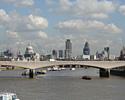
Turning away from the station area, the course runs along Belvedere Road and the area known as the South Bank. Here we pass by the Royal Festival Hall - one of the city's premier concert venues, the Queen Elizabeth Hall, the National Theatre and the London Television Centre before arriving at Blackfriars Bridge and a traverse back to the north side of the River.
|
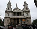
Passing to the side of St Paul's, we head towards Mansion House before swinging left up Queen Victoria Street and the Bank of England. Here in the heart of the financial district, the many columned Bank sits comfortably among the modern skyscrapers like Tower 42 and 'the Gherkin'.
|
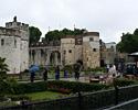
As Eastcheap becomes Tower Street and then Tower Hill, another of London's iconic buildings comes into view. Classified as a World Heritage Site by the United Nations, the Tower of London was started by William the Conqueror in 1068, and was continually added to by several monarchs over the centuries until it became what it is today.
|
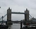
On crossing the river, there will be a special ceremony with London's Mayor: Ken Livingstone, whose headquarters are in City Hall on the southern bank. Luckily we are still in the neutral zone!
Inevitably, as we head away for the city centre, the tourist attractions become rather thinner on the ground than before. Once across the river we turn left on to Jamaica Road and pass by the districts of Southwark, Bermondsey and Rotherhithe.
|
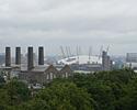
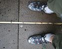
Further along, the road passes between the Old Royal Naval College - now part of the University of Greenwich - and the national Maritime Museum. The skyline to the left is dominated by the skyscrapers of Canary Wharf, built on London's old derelict docklands area on the Isle of Dogs, and the Millennium Dome (now called the O2 after the mobile phone company that sponsors it). To the right though, on top of the hill in Greenwich Park is the reason that the real start is here, the Royal Observatory, and the thing that put London in the centre of the trading world, the Greenwich Meridian.
|
There is a tired old cliché that goes something like, "when a man is tired of London, he is tired of life", so it will be with heavy heart that the peloton heads east along the Trafalgar Road through Woolwich towards Plumstead, Erith and Kent. But having checked their bearings, and set their watches, the riders can safely continue on their pilgrimage to Canterbury, safe in the knowledge that they know their place in the world.
Also see Tourist's guide to London: Tour 2007's Prolouge Route.
Photography
For a thumbnail gallery of these images, click here
Images by Ben Atkins/Cyclingnews
- The view up the Mall to Admiralty Arch (the weather will be better on July 7th!)
- The lake in St James's Park is one of the most tranquil spots in London.
- The park's gardeners have created their own tribute to welcome the Tour.
- Yes, it's him again. The Duke of Wellington stands on a column overlooking Waterloo Place.
- The Parade Ground at Horse Guards are overlooked by the houses of Downing Street on the left.
- Admiralty Arch where the Mall joins Trafalgar Square.
- Trafalgar Square. Haven't we been here before?
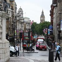
- Red bus, black cabs, Big Ben? We must be in London!
- The London Eye now dominates the skyline of the South Bank.
- Parliament and the grand buildings of the Victoria Embankment where the route will pass on the way to Westminster Bridge.
- Westminster Bridge immortalised by the poem of William Wordsworth will be the first of three river crossings.
- The London Aquarium was once County Hall, headquarters of the Greater London Council.
- The Houses of Parliament as seen from Westminster Bridge.
- The Royal Festival Hall built for the Festival of Britain in 1951, is pretty unspectacular on the outside, but plays host to some pretty spectacular concerts.
- Waterloo Bridge and the city skyline one of the most recognisable sights in the world.
- It's definitely on its way!
- The Tate Modern art gallery, as seen from Blackfriars Bridge.
- St Paul's Cathedral is really difficult to take in!
- It's easier to take in Wren's finest work from the side.
- The Bank of England at the heart of London's financial district.
- The Monument stands near the spot where the Great Fire of London started in 1666.
- Yum! Pudding Lane! The place where the Great Fire started.
- The Tower of London named as a World Heritage Site by the United Nations.
- Tower Bridge one of London's most iconic structures.
- City Hall, HQ of the London Assembly, sits on the South Bank, opposite the Tower.
- The old and the new. The Tower of London sits comfortably alongside the city's skyscrapers.
- The magnificent palatial building of the old Naval College.
- Unfortunately the Cutty Sark was almost completely destroyed by fire this Spring.
- The Royal Observatory, Greenwich is the centre of the world!.
- The towers of Canary Wharf now loom over London's old docklands.
- London's Millennium Dome (now officially called O2) has always been controversial, but is finally becoming a success.
- Zero Degrees Longitude is what puts Greenwich at the centre of the maritime world.
- A foot in each Hemisphere. Stage 1 proper starts here!
