Bill's Photo Guide to the Amstel Gold Race
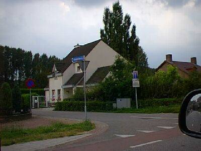
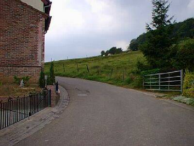
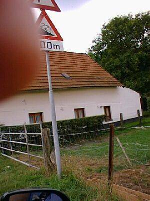
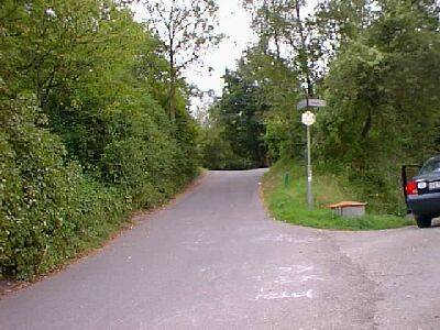
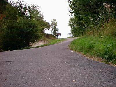
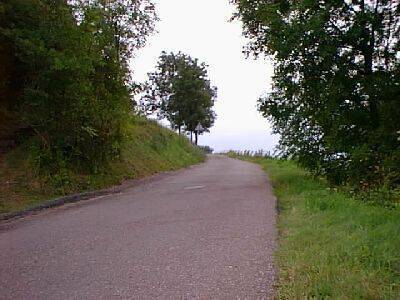
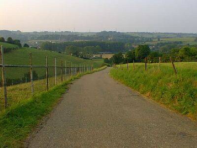
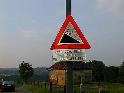
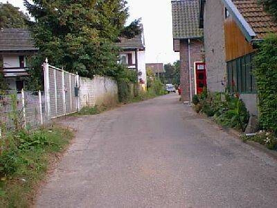
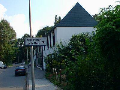
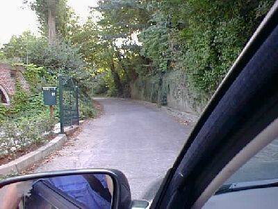
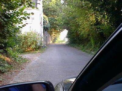
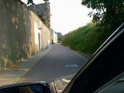
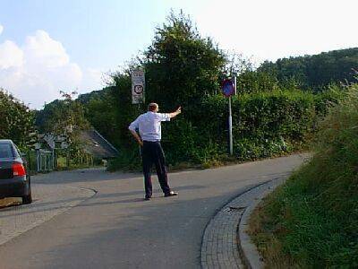
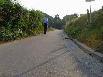
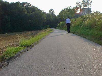
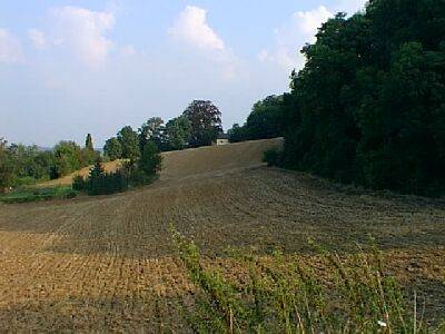
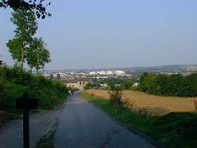
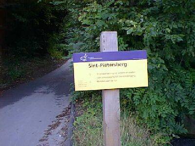
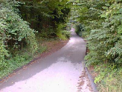
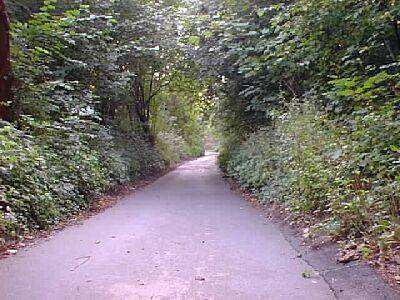
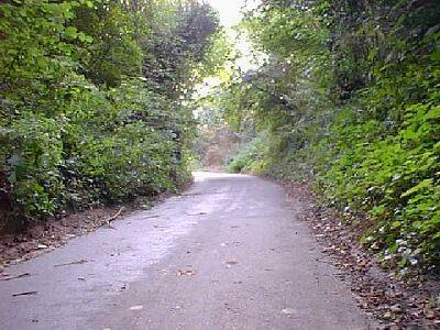
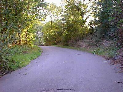
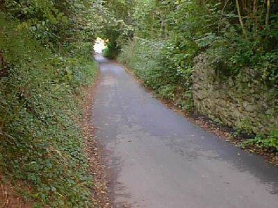
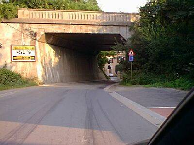
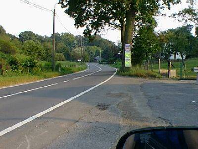
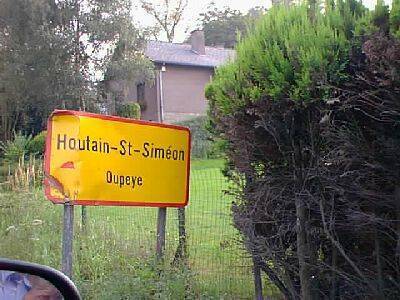
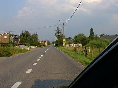
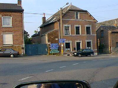
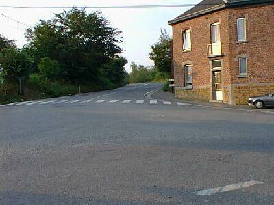
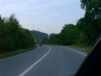
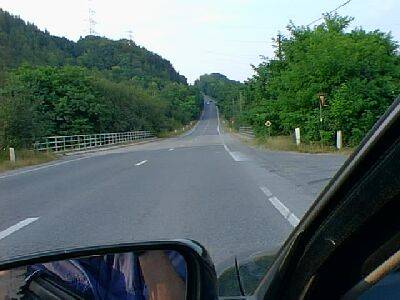
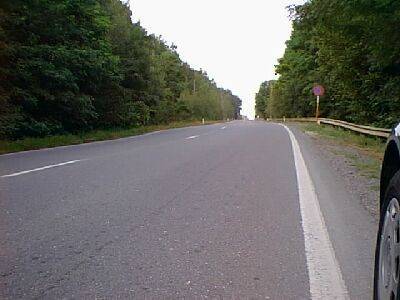
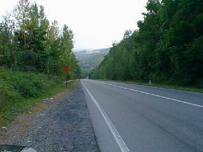
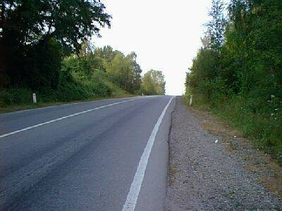
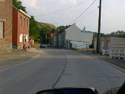
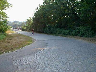
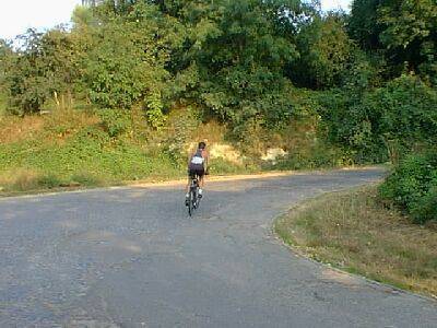
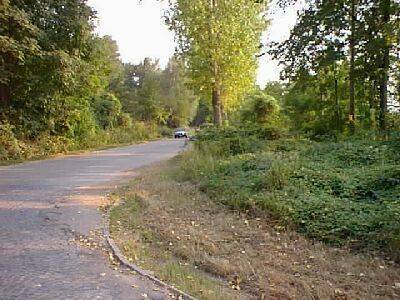
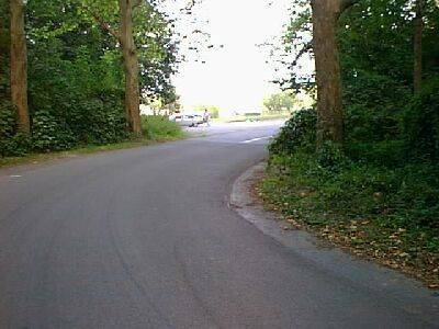
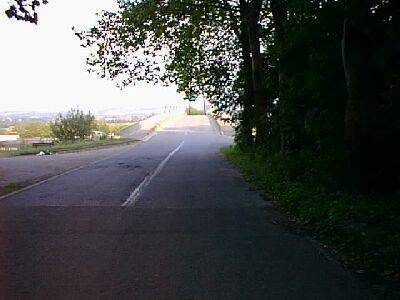
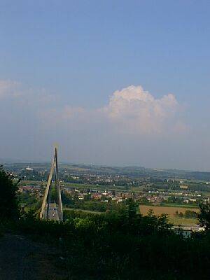
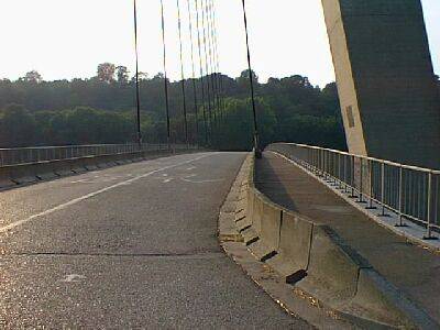
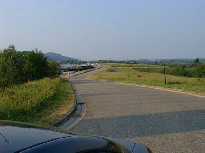
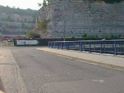
Bill's Photo Guide to the Amstel Gold Race in Zuid-Limburg:The Amstel Gold Race is staged in Zuid-Limburg (South Limburg) in the "Heuvelland" (hills) of the Netherlands....the alps of the Netherlands.Well when most of the place is below sea-level, a ramp of the main road to Eindhoven is probably a hill. But I have to say that while I joke, this is one of my favourite parts of the world. I go there every year (live in Maastricht) and have raced on all the roads of this region. I would like to think I know all the roads and the hills and so for me the Amstel Gold Race is very special. Not tough enough to be on par with the RVV or LBL but still full of classic narrow farm road "killer" climbs and a winding route through beautiful Dutch villages. And my favourite climb of anywhere...the Keutenberg, just off the main road from Valkenburg to Vaals. You go past this holiday camp along a narrow lane, turn right and then left and suddenly the gradient is sheer (23 per cent), and then for around 800 metres you climb up this narrow track up over the farm land below, finally coming to a small group of houses at the top. So lets take a tour of the race route from start to finish with some photos along the way. The race starts this year in Maastricht. In previous years it has started in Heerlen out on the German border. But this year the riders assemble in the Markt which is close to the River Maas and in the centre of Town. The race heads directly north along the Maas and after 4 kms comes to Bunde. The route is flat and passes through an industrial estate north of the Nord Brugge which is the major bridge on the north side of town. Bunde is a small farming village. After 11 kms, the race enters the town of Elsloo, which is famous for an old castle alongside the River Maas. The narrow road - the Maasberg up to the main village from the castle is cobbled and relatively slippery in the rain. The next stop is Stein, another of the villages between the River and the main highway to the North (Eindhoven). They swing to towards Geleen (24 kms) which is over the highway heading east. There is an old coal mining district here. The riders pass through Beek (4 kms south of Geleen), and encounter the the 500 metre long Adsteeg. Sharp but not particularly tough. Through Ulenstraten, which is near the International Airport (now called Aachen-Maastricht Airport for political reasons). Down the delightfully named Humcovenstraat takes you into Meerssen with 37 kms now done. Meerssen is just north of Maastricht and home of the Dutch National Road Championships each year. Coming out of Meerssen heading north east the riders encounter the only significant test in this area is the Lange Raarberg (length 1500m, height 130m) which climbs up into the village of Raar. We are at the top of a ridge here with Valkenberg to the south in a valley. The race passes through Groot-Haasdal, Hulsberg (with the Emmaberg a small test). By 48 kms the race passes through Valkenburg for the first time after coming down the hill from Hulsberg. The "falcon village". It is a place to stay away from in summer because it is a major tourist centre in the zuid-limburg region. It is full of outdoor bars, souvenir shops; it has a Casino and some questionable sorts of night spots, mini golf, and it is pretty gaudy. it does have a nice cave built into the ridge that runs along this area and they used to mine a distinctive rock which was used in the buildings in this area. It has one gem -De Cauberg, the hill that goes out of the centre of the village and takes you along a back road along the plateau and down into Maastricht some 25 kms away (direct). De Cauberg comes later in the race. The riders pass through Valkenburg several times during the race due to its central position in the region. They now head north-east to the next village called Klimmen. It is a long climb out of Valkenburg to Klimmen. They ride out along the Geul valley and then over some hills to Ubachsberg (just south of Heerlen) some 6 kms after Klimmen. The climb of Bergse Weg (length 800m, height 170m) is encountered here. It is fairly testing. Not long but a sharp rise. They pass the Colmont Camping Park (the region is full of camping parks) and head back towards Valkenburg (approximately south west). Under a small bridge at Wijlre, with some 'drempels' (sleeping police) to watch out for here. The main road takes them through Schoonbron, Schin op Geul (64 kms), and Oud Valkenburg. Just as they come back into Valkenburg, the race turns left into a seemingly harmless suburban street and they start climbing up between the rather large houses (for Dutch standards). This is the Sibbergrubbe (length 1200m, height 159m). It winds up the hill, leaving the houses and enters a canopy of trees. The descent is fabulous but you have to watch for cars because the road is quite narrow and the sweeping bends rather tight. There is a footpath on one side for emergency bunny hops to avoid cars - I have used it often! The Sibbergrube takes the race into the village of Sibbe on top of a plateau above Valkenburg. Once through this little rural village, the riders descend into Valkenburg via Daalhemmerweg. In Valkenburg they head for Berg en Terblijt and this requires a left turn up De Cauberg. The climb is used in almost every race that goes through this area. In racing I have always used a big ring (53) and about a 19 to 21 depending on how shot I have been. But I am light. In training, we go up it in a 42 and complain about how steep it is. It starts climbing straight out of Valkenburg along the shops and small houses, and through an row of overhanging trees. After about 800 metres you veer slightly to the left and it flattens a bit but by then your legs are suffering. Over the top you veer to the right, head west to Maastricht. The road descends (marginally) into Berg en Terblijt and past the finish of the 1992 Stage 7 of the Tour de France. The riders pass through Vilt and Berg on their way into Maastricht for the first time. The descent off the plateau is long and steep. Maastricht 78 kms - is an old town on the river Maas (meuse) and has about 100,000 people. It gets quite crowded in summer. The ceramic industry is big and it has a large regional university which was built in the early 1980s to compensate the Limburgers for the closure of the coal industry. Into Maastricht the race turns left and heads back up to the hills via Cadier en Keer (Bemelerweg). At Bemelem they ride along Oude Akerstraat and start the winding climb of the Bemelerberg (length 700m, height 125m). Again a great descent but a tough climb. Just when you think it is over it comes up to a false flat which runs up along a high fence. The road is still rising here as you come into t'Rooth. Heading more or less south-east, Honthem, Eckelrade and then St. Geertruid are passed. From Langsteeg (St. Geertruid), they descend through the trees into Mheer and follow the road towards Noorbeek. This is a little village out on the Belgian border. Through the cobbled village centre (the bike really shakes), the next tough rise is encountered as they turn left of the main road and reach the village and climb of Bergenhuizen (lenght 500m, height 180m). The village is between Mheer and Norbeek). I recall once being out and climbing slowly up Bergenhuizen which goes sharply off the main road from Gronsveld (which also has a decent bike shop) and Noorbeek. You turn left and it is very steep until you start easing through some houses and then you come to a T with some old farm houses and fields at the top. This day there were three little kids on their bikes hanging around a farmhouse at the top as I gasped by, and they said "Gert Jan Theunisse - nu kop!", which says they think he is the top. I muttered something like "ja, een kop dopen taker, dat mag er zijn". This was just after he had been in strife with the UCI. From here you ride across the narrow farm roads and into Terlinden. Turn sharp right and head to Hoogcruts, which is a few farm houses and barns (and maybe a cafe) on the cross road (Maastricht to Verviers, Slenaken to Noorbeek). Turn left and ride down a very sharp hill with a great right sweeping bend and then climb marginally into the tourist village of Slenaken. Next test is the very long De Loorberg (lenght 1200 m, height 220m). It is located in a camping, forest-type area just near Slenaken. It is a steady slope. There are large hotels at the top. Down into Gulpen (famous for its Brewery and home of my pal Tom). This involves the first pass over Gulpenerberg (length 900m, height 155m) at 112 kms. Gulpenerberg - home of the Foreldorado fun camp, home of the World Cup MTB course and also the location for the Cyclo Cross course. Gulpen (pronounced hoolpen = sort of) is a village built in a valley and extends up either side of the hill. Each year (about) the Geul River floods and leaves a lot of nasty residues which have come up the Maas from the Belgian industry area around Liege. People have to change the topsoil when they sell houses in this area. My favourite aspect of Gulpen - surprise surprise - is the Gulpenerberg which is on the east side of the road (N 279) coming from Maastricht, or south as you come in from Vaals (direction from Germany). While only around 160 metres high it is a really steep climb to the top. Once up the top you get great views of the south-east of Limburg. If you are on a bike racing you get a view of nothing much at all. You are just gasping. Across some very narrow farm roads with tourist camps all over, the race goes south east through Mechelen and then they climb another fairly steady but leg-sapping and long climb called the Schweiberg (length 1700m, height 220m). It goes through the centreof the village and through the Kosberg. This is in the extreme south east of Limburg and is a very popular picnic, camping and bar area.There are several very sharp hills coming in and out of the forest area. All around is farming land. Down into Eperheide (a great descent) and next stop is Epen (a tourist village) which is in the bottom of the valley here. You turn sharp left at the end of the village and off-camber down hill (It is very easy on a damp day to hit this corner too fast and to end up across the road into a fence which is on the corner. Not me. But I have seen it happen. Generally you have to make sure you don't overcook the corner. Then it is down the road, left sweep, right, across the Geul bridge, on the right there is always an ijs van (ice cream) which gets big lines of customers on a Sunday. The road starts winding up and you are then ascending the tough Camerig (length 3000m, height 270m) - it is long - 3kms and winds up to the left at a steady slope although about half way as it swings to the left it seems to get pretty tough. On the left is a caravan park and then a bar. As you enter the forest, it goes down a bit and then swings to the left, deep in the forest, and rises sharply again. At the top, you turn right and head along the plateau through the trees. Then you come out and descend sharply with some switchbacks down into the direction of Vaals. Before they reach Vaals however, they turn right to Wolfhaag and via Gemmenicherweg they reach the Belgian town of Gemmenich at 135 kms. The descent into the village is very exciting. It is a little Belgian village and very near to the German border. It is a pretty village set on a hill and the climb out of Gemmenich (length 600m, height 280m) is shortish but hard. Next climb is the are very close to the Drielandenpunt (height 320m) - the place where you can be in three countries at the same time. Germany, the Netherlands and Belgium. The Three Lands Point is the Hoogste punt van Nederland (the Highest Point) and is about 340 metres. A great ride early in the morning before the tourist traffic starts. The road is very winding to the top and the view is pretty neat. Next town is Vaals (Netherlands) at 139 kms which is a non-descript border town with another good bike shop. Through Vijlen and at 144 kms they climb up the very tough Vijlenerberg (length 1000m, height 260m) which is rather like the hills in the Ardennes that we see in the LBL. Many riders start to suffer at this point. From there they pass through Epen, and then up another tough Ardennes-type climb - Eperheide (length 1400m, height 220m) at 153 kms on the way back to Mechelen. Heading towards Maastricht again they come into Gulpen via a very narrow path called the Oude Heirbaan. Up the Gulpenerberg again. and then via Teheuxweg they head east towards Germany, crossing the N278 (main road from Maastricht to Vaals-Aachen), and into the village of Whalwiller at 165 kms. Heading north now the riders have to go over the very short but hard Kruisberg (length 600m, height 170m). They cross farmland along narrow roads and then cut over the road from Wittem to Simpelveld. There is a very dangerous and narrow bridge here into the village of Eys at 167 kms. The riders then turn left off Witenerweg and into Eyserbosweg along their way up the very hard climb of Eyserbos (length 900m, height 180m). Y ou approach this by descending off the main road, then past a couple of houses and then it goes straight up. Along the track (very narrow) is a park of sorts with lots of heavy trees on the left and fields on the right. At about 3/4 up there is a religious monument (common here) and if you were religious you might seek some intervention. Phil Anderson attacked here with great success in the past. As you come out of the overhanging trees at the top there are fields, a picnic area and a communications tower. The roads at the top are flat. Tough climb. At the top is Eyserheide at 170 kms. They then pass through Trintelen, Bosschenhuizen and into Simpelveld. Then at 175 kms they pass through Huls and up the tough Ubachsberg (length 900m, height 230m). Heading back in the direction of Valkenburg now, south west and across farming country and rolling hills and small lanes. Next climb is at the village of Fromberg (length 1200m, height 160m) a typical heuvalland climb. Following the descent into Etenaken you are just about ready to hit my favourite. Crossing the main road you head south via Schoonbron and Schin op Geul (along the Guel Valley). Next village on the main road is Keutenberg which is in two part - the houses down on the flat and the farm houses at the top of the climb. The Keutenberg (length 400m, height 165m) So at 186 kms the race turns left off the main road and into the village of Keutenberg. You go through the village and past a caravan park along a flat narrow lane then you veer right and left and the Keutenberg starts. Make sure you have low gears as it gets very steep quickly. The sign warns you that it has a 22% gradient. Straight on to the climb. 1/5 of way up and the climb starts getting steep. By the 1/3 mark the gradient is relentless. I have fallen off here lots of time in the wind, when I have chosen the wrong gear to hit the first corner with. It is 42-23 territory. The climb is then straight up the side of the hill with a valley down below (increasingly below) to the right. As you are gasping, you come to a set of farm houses - in the best location of any house in Europe I think! If you are at the top you can look back down the climb. At the top the sign says it all - very dangerous hill. Once over the top the riders come into through the farm houses as the road flattens out and heads to Ingber. They ride along the plateau through Ingber, Scheulder and Ijzeren into Sibbe and down into Valkenburg again at 194 kms. Second time up De Cauberg (length 1000m, height 150m), then to Berg en Terblijt and Vilt again. This time they take the Rijksweg and then the Slakweg before coming to the next test at 200 kms - the Geulemmerberg (length 600m, height 125m). You come through some trees running along the Geul and then across a small bridge and turn left past a pub on the right and the climb starts and runs up the through all the houses into the small village of Berg. At the bottom is another great bike shop although it is slightly expensive. At 204 kms the race goes back into Maastricht and only 52 kms around the south of Maastricht into Belgium left. To the south of the town they cross the Kennedybrug (over the Maas). The Kennedy Bridge is the south span of the Maas in Maastricht. Just prior to crossing the bridge you pass the Exhibition Centre where they have rock concerts and also sign important treaties governing European Integration. Don't get the idea that the now (in)-famous Maastricht Treaty was signed in some old European building with chandeliers. No way - it was signed in a huge tin shed. A winding path of the bridge and left into Maasboulevaard and past the finish line for the first time at 209 kms. On the left is the river and the Lage Kanaaldijk. There are many 'drempels' to ride over. And then the next test arrives - St. Pieter op de Berg. St. Pieter op de Berg (length 900m, height 120m) It is a tough hill just south of the city. There is an old fortress on top of the hill overlooking the Maas to the east. Along the Maasboulevard you approach St. Pietersberg by taking a right hand turn. The first section is not hard and winds up to the left under some trees. After the initial sharp section the climb sweeps left and runs alongside a row of houses, climbing gradually. You keep riding further along the row of houses. After the row of houses the climb turns hard right and starts getting steeper through open farming fields. This is the view as the riders turn right and approach the toughest part of the climb. It is quite sharp through the fields. To give you an idea of the slope here is a profile as the riders go through the 250 metres of farm fields. Looking back - down the starting section of the climb to get an idea of the gradient. The 250 metres through the fields takes the riders to the the entrance to the narrow path undercover of trees which forms the main part of the climb. It now winds left up through the bos (small group of trees). It starts getting steep as they ride under the trees. Steeper at 40 per cent of the way up. Then at 50 per cent of the way up it starts to swing to the left with still more to come. You get an idea of the climb by looking back down from the top. Nearly to the top it then swings right through a narrow gate over a cattle grid. Down into Maastricht again at 212 kms, they head north along Prins Bisschopshingel past the Police Station, then at the roundabout at Tongerseweg the turn left and left again into Cannerweg and head south to Belgium and Kanne past farming land. On the right is the Chateau Neercanne a very expensive restaurant set up into the trees looking above the farm fields. The 1992 Tour de France came into Maastricht using this road. At 217 kms they pass through Kanne (a border town between Belgium and the Netherlands) and turn right up the very sharp Muizenberg (length 900m, height 105m). It climbs up to the Albertkanaal and the riders pass alongside it until they get to the N79. The Albert Kanal was built in the 1930s depression and take big barges north across Belgium. They head to Vroenhoven and at 222.2 kms they reach Riemst. Riemst is this non-descript Belgian town which always seems to be asleep when I ride through it. They head south-east along the road to Wezet (Vise). and reach Valmeer at 224 kms. The route then goes through the rather grimy Belgian town of Bassenge with lots of stone buildings. I get depressed along this road. The Rue de la Paille then left into the Rue G.Fraikin then the Rue Neuve- and under the bridge (viaduct) to Houtain-St-Simeon which is the entry to one of the last climbs of the race. Saint-Siméon - Belgium (length 1200m, height 135m) You start the climb of Saint-Siméon once you go under the bridge. It is a constant climb up to the village at the top. The sign on the right signals that the climb is underway. Once you get over the top you pass the village and descend for a few kms. Down the other side From Saint-Siméon the descent of the Rue de Tongres takes you to Haccourt (Belgium) at 234 kms. It is a pretty ugly and dirty industrial town. Halembaye (length 1000m, height 155m) The next big test is the Halembaye at 236 kms. The Halembaye is not a big ring hill. You go across a small bridge and it starts to climb. It is about 1 km long and gets steeper towards to top. Many major breaks are made on this hill in local and major races. The Tour of Liege goes through this area. The hill is straight up - no curves. That is what is so imposing about it as you approach it. Haccourt you can turn right to Vise or left to Maastricht (and Halembaye). The race turns left and it is flat until the climb with a fast road surface here. There is a big garbage dump on the left and cement works down on the Maas River to the right. Halembaye is ahead. It looks very steep from a distance. Across the bridge and the climb starts. It is pretty steep and this shot is taken on the climb about three-quarters up. Looking back down from the top gives an excellent view. Just as you reach the top there is a sharp slope change. At the top, it is fast down into Wonke then up a sharp right veering hill, right again and a fast road down into the village of Eben-Email (via Rue d'Eben) at 242 kms. The race turns right of the road to Kanne and Maastricht and the climb of St Pierre approaches. By the way, embedded in the side of the Maas on the Belgian side is a fortress called Eben-Emael. It was built to defend Belgium from the Nazis and took some 5-7 years to finish. The Belgians believed it was impregnable and it has kms of tunnels and underground rooms etc. It took the Germans around 20 minutes to take as they swept into Belgium. It is a fabulous place to visit on its once-a-month open days. Cote de Saint-Pierre (length 1000m, height 130m) The houses at the botton are on the Belgian side. From the village you sweep right, left and then start climbing. When I went out to get these photos I saw this triathlete come by. So why not have a bike (well sort of bike) in the photo!. The rise out of the village comes to a very rough, cobbled switchback corner. After the corner the second stretch comes. The climb swings to the right and you come out of the trees across the plateau with farm fields on both sides of a narrow, often wind-swept track. Then sweep left as you descend towards the Maas River. Sweep right and a long fast straight section before a very tight, cobbled left turn (180 degrees). As you come down this next section through trees, the River is on the right. There is a hard right turn at bottom of Saint Pierre before the bridge over Albert Canal. You see the bridge through the trees. The bridge is pretty spectacular. Coming off the bridge facing the directions the riders come. Over the Albert Kanal the riders turn left alongside the east side of the Canal. A short flat wind-exposed section then follows They turn right and head to Maastricht via Petit Lanaye at 248 kms. There are some obstacles in the road here to slow down the traffic. 3 kms later they reach Maasboulevard again and turn up to the Zonnebergweg (which is the other side of St. Pietersberg) and at 254 kms they come into Maastricht again into Prins Bisschopsingel and then via Centrum into Maasboulevard again for the sprint at 256.5 kms. |